University of Exeter
Type of resources
Topics
Keywords
Contact for the resource
Provided by
Years
Formats
Representation types
Update frequencies
-
This dataset comprises raw carbon, oxygen and hydrogen stable isotope data on water (precipitation and terrestrial) and plant cellulose from Empodisma-dominated peatlands throughout New Zealand. This data has been published in two open access papers: Amesbury, M. J., Charman, D. J., Newnham, R. M., Loader, N. J., Goodrich, J. P., Royles, J., Campbell, D. I., Roland, T. P. and Gallego-Sala, A. V. 2015. Carbon stable isotopes as a palaeoclimate proxy in vascular plant dominated peatlands. Geochimica et Cosmochimica Acta 164, 161-174. Amesbury, M. J., Charman, D. J., Newnham, R. M., Loader, N. J., Goodrich, J. P., Royles, J., Campbell, D. I., Keller, E. D., Baisden, W. T., Roland, T. P. and Gallego-Sala, A. V. 2015. Can oxygen stable isotopes be used to track precipitation moisture source in vascular plant dominated peatlands? Earth and Planetary Science Letters 430, 149-159.
-
Description of peatland sites included in the compilation of carbon accumulation rates, including resolution (high, low), interpolation (yes/no), contributor name, country, lon, lat, peatland type, dominant plant type, no. of dates used in the last millenium carbon accumulation rate calculation, and problems with the data. Peatland sites at northern hemisphere high and mid latitudes (260), tropical (30) and southern hemisphere high latitudes (7 sites).
-
Non-contact Atomic Force Microscopy images (NC-AFM) of surface nanobubbles on the carbonate mineral dolomite. Since surface nanobubbles were first imaged in 2000, they have been of growing interest to research due to their long lived properties, with reported lifetimes as long as several hours. Images of nanobubbles were produced under water, collector and depressant conditions using the air water supersaturation method. These are the first images of surface nanobubbles on dolomite. Surface nanobubbles could play a part in the processing of dolomite via froth flotation. These images lay a foundation for future analysis of the effect of nanobubbles in flotation.
-

Benthic stable isotope (carbon and oxygen) data from IODP Site U1445. Generated by Yasmin Bokhari-Friberg, supervisied by Kate Littler and Pallavi Anand.
-
Non -contact atomic force microscopy (NC-AFM) images of surface nanobubbles on the fluorcarbonate mineral synchysite. Synchysite is a rare earth fluorcarbonate mineral which has previously been relatively unstudied. Since nanobubbles were first imaged in 2000, they have been thought to play a intigral role in mineral processing. Images of nanobubbles were produced under collector reagent conditions favourable to flotation. These are the first images of nanobubbles on the fluorcarbonate mineral synchysite. Nanobubbles at the surface of synchysite improve the understanding of both flotation and nanobubble formation.
-
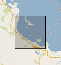
This dataset comprises a record of benthic foraminifera count data from three cores that were analysed to assess down core changes in foraminifera abundance from the Paluma Shoals reef complex, Halifax Bay, central Great Barrier Reef, Australia; cores OPS-PC2, OPS-C-PC1 and OPS-D-PC1. The site/core names relate to the sites described in the following paper: Morgan KM, Perry CT, Smithers SG, Daniell JJ and Johnson JA (2016) Extensive reef development within the “mesophotic” nearshore Great Barrier Reef: Evidence for intra-regional variations in coral resilience. Scientific Reports 6:29616. DOI: 10.1038/srep29616.
-

This document is the drillers log of strata encountered during site investigation work. The log was made in the field during drilling at Prees, Shropshire on 8th to 10th January 2020. The log includes basic information on lithology and drilling equipment used and depths of the individual core runs.
-

We report sedimentary coatings and fish teeth neodymium isotope values – tracers for water-mass mixing – from deep-water International Ocean Discovery Program (IODP) Site U1438 (4.7 km water depth) in the Philippine Sea, northwest Pacific Ocean. The time period encompasses the last 20 million years.
-
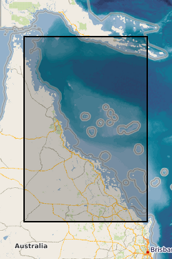
Four datasets for NERC grant NE/J023329/1, Paluma Shoals reef complex, Halifax Bay, central Great Barrier Reef, Australia. DATASET 1: Single Beam acoustic survey data. This dataset comprises the single beam acoustic data that was collected from transects across the Paluma Shoals reef complex, Halifax Bay, central Great Barrier Reef, Australia. The dataset comprises of depth measurements (m) and the latitudinal and longitudinal coordinates of 58,255 point samples across the study area. The dataset was used to construct Figure 1C in Morgan, K. M., Perry, C. T., Smithers, S. G., Johnson, J. A., & Daniell, J. J. (2016). Evidence of extensive reef development and high coral cover in nearshore environments: implications for understanding coral adaptation in turbid settings. Scientific Reports, 6. DATASET 2: Paluma Shoals core data (sedimentology and palaeoecology This dataset includes all collected sedimentary and coral palaeoecological data collected from cores from across the Paluma Shoals Reef Complex, Halifax Bay, central Great Barrier Reef, Australia. This includes 1) a list of the cores recovered, their geographic location and their depths; 2) data on the mud and carbonate content of the sediment matrix from each core; 3) grainsize data from each core; 4) data from thin section analysis from each delineated facies in cores; and 5) downcore data on coral constituent abundance. DATASET 3: Core radiocarbon dates This dataset comprises the radiocarbon dates obtained from coral samples from cores collected across the Paluma Shoals Reef Complex, Halifax Bay, central Great Barrier Reef, Australia. Dates are from the NERC Radiocarbon dating lab (SUERC) in East Kilbride. DATASET 4: Benthic video imagery This dataset comprises screen grab images collected along towed transects across the Paluma Shoals reef complex, Halifax Bay, central Great Barrier Reef, Australia. Each image has the relevant lat, long coordinates printed on the top right hand corner. The sites names (folders) relate to the sites described in the following paper: Morgan KM, Perry CT, Smithers SG, Daniell JJ and Johnson JA (2016) Extensive reef development within the “mesophotic” nearshore Great Barrier Reef: Evidence for intra-regional variations in coral resilience. Scientific Reports 6:29616. DOI: 10.1038/srep29616
-
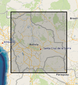
The data in this file represent measurements of the the depth, grain size characteristics and sedimentation rate for sediment cores collected from the floodplain of the Rio Beni in 2011, 2012, and 2013. The age of floodplain sediments was determined from measurements of the Pb-210 activity of floodplain sediments within the cores. The sample collection and laboratory techniques and data analysis procedures used to obtain these data are described in: Aalto, R & Nittrouer, C.A. (2012) Phil. Trans. Royal. Society., vol 370, p 2040-2074. This is an ascii text comma delimited file. Each row in the file represents a sediment core. The file contains 12 columns of data representing: column 1: The core name column 2: The latitude of the core location in digital degrees column 3: The longitude of the core location in digital degrees column 4: The year in which the core was collected column 5: The depth of the floodplain core (in cm) column 6: The age of the oldest sediment in the core (in years) column 7: The depth to the oldest sediment in the core (in cm) column 8: The estimated mean sedimentation rate for the core (in cm per year) column 9: The percentage of the core comprised of clay column 10: The percentage of the core comprised of silt column 11: The percentage of the core comprised of sand column 12: The mean density of sediment in the core (in g per cubic cm)
 BGS Data Catalogue